Even with a good guide book it can be difficult to find places that are a bit off the beaten path. Roads may have changed, descriptions are often not quite right, and distances may be inaccurate. Usually a bit of back tracking and second guessing is involved to make it to your final destination.
Such was the case with getting to the waterfalls on Whychus Creek. My guide books (yes, plural—it’s good to have a second set of directions) were both pretty good at getting me to the junction of Forest Service (FS) road 1514 and FS 1514-600 but things got a wee bit confusing. Both books mentioned a 2 mile (approx. 3 km) drive down a dirt road and several junctions and turns. One book suggested taking the first left fork off of FS 1514-600, but that didn’t look right at all.
I ended up taking what looked like the more well used and maintained road straight. It went about 1.5 km and then dead ended in a promising looking parking area. Again, I second guessed myself because the road ended way too soon, but there were some info kiosks lying on the ground covered with black plastic so I figured I was probably in the right place. The road did continue onward but was deactivated. So—a shorter drive than expected and no turns or junctions.
From the parking area there was what looked like a well used trail (complete with guiding arrow) leading into a surreal burned out ponderosa pine forest. Waterfalls Of The Pacific Northwest (David L. Anderson, 2007) mentions a beautiful walk through a forest so I think that things may have changed a little since his book was published. Nevertheless, the blackened forest was spectacular and in the early morning light made for interesting photography.

The trail eventually ended up in an open area overlooking Whychus Creek. A road signed FS 600 entering the clearing made me think that perhaps this was the parking area mentioned in the guidebooks. It might be still accessible by 4×4 vehicle, but the easy 1.5 km walk through charred ponderosa forest is a more interesting way to begin the hike out to the falls.

From here the trail got a little rougher with occasional blowdown blocking the path. In places it took a bit of reckoning to figure out where the trail continued on the other side of the fallen trees. Not a problem if you’re taking your time and thinking things through. Wouldn’t want to try it after dark, even with a flashlight.
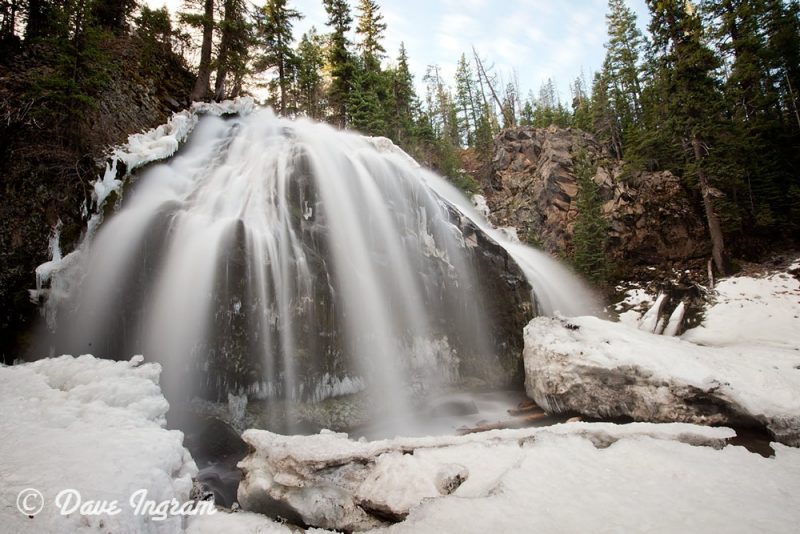
It’s a relatively short hike from the clearing to the 17 m high Chush Falls, the first major waterfall on Whychus Creek. From the viewpoint it is possible to get partially obscured views of the spectacular waterfall. A rough and steep path takes you down to the creek, but views aren’t the best from this vantage point at this time of year. I bushwhacked up and around some logs and got to a place where I could take some photographs.

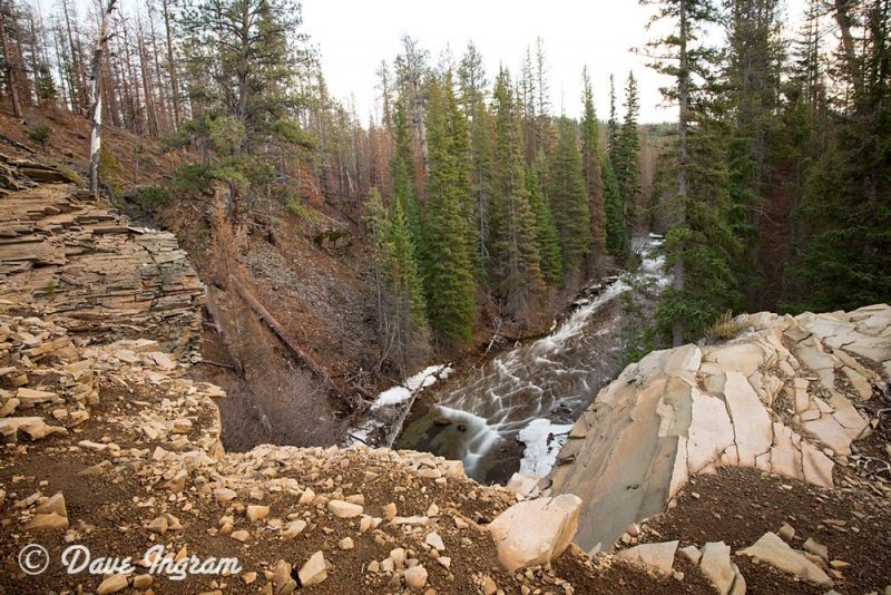
From Chush Falls I continued on an even less maintained trail that follows Whychus Creek upstream. A further 350 m takes you to a viewpoint of a second water fall called the Cascades. Here the creek drops about 10 m. Views aren’t great and it didn’t look like there was an obvious way to get to the base of this waterfall.
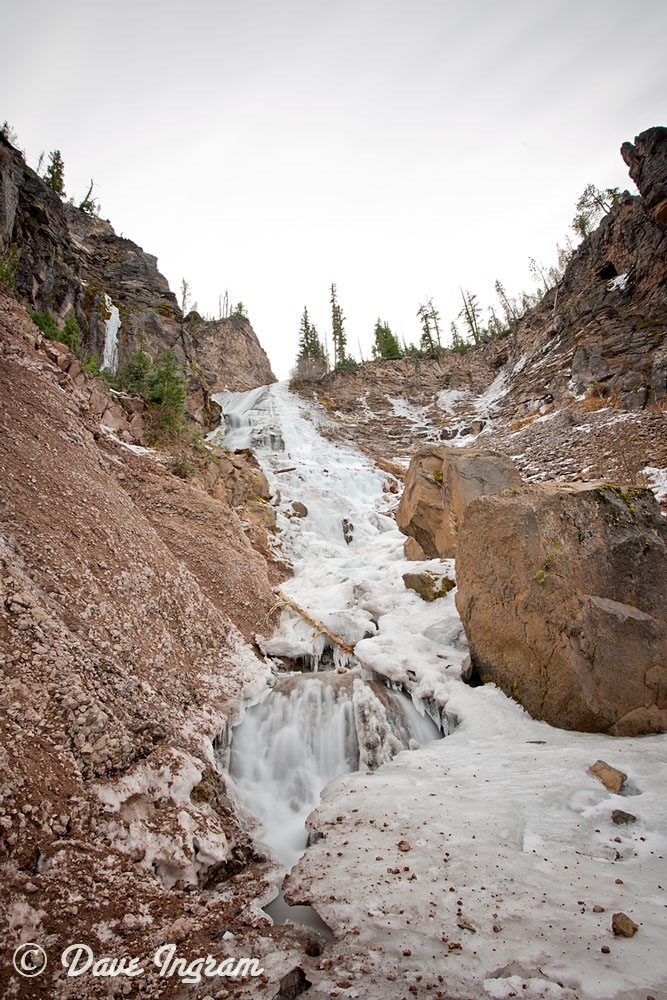
My final destination was the source of Whychus Creek, the dramatic 70 m drop of Whychus Creek Falls. The path followed the creek from the Cascades and more challenging to follow. It often petered out and disappeared, but I was able to pick it up again with a bit of backtracking. Since it more or less followed the creek it was easy enough to stay on track by keeping the sound and sight of the creek near.

After another 350 m the trail ended at the base of Whychus Creek Falls in a bit of an alder gully with steep scree slopes and the creek running through snow at bottom. I scrambled up a bit to get to a better vantage point to view the falls, but it was a bit dodgy so I decided to work my way back down sliding carefully in a sitting position. It was easier to walk up on the snow and much safer.
I spent some time enjoying the falls and creating some photographs. Small pebbles rolled down the scree slope to the snow covered creek almost continuously. It looked to be a very dynamic landscape with a great deal of erosion.
Conscious of the time and not wanting to do the rough section of the trail in the dark it was soon time to head back. Even with good light there were a couple of places where I lost the trail for a short time before finding it again. Between Chush Falls and the end of the road trail I ran into a family of three heading in to the falls. I think they must have passed me on the way out while I was photographing some burned trees. And on the main road I ran into a pair of hikers running in about a half hour before dusk. Hopefully they made it out OK.
These three falls and the burned forest make for an excellent day hike. Chush Falls is a beautiful destination in itself and for a little extra challenge you can continue on to the Cascades and Whychus Falls. Just make sure that you’re aware of the time during these shorter winter days and that you’ve got a flashlight with you.