
A hundred years ago, the name of Ripple Rock evoked dread in the hearts of mariners, but today entices hikers to explore natural history as well as human history, on the Ripple Rock Trail. The stretch of water in Seymour Narrows, part of the Discovery Passage north of Campbell River, is famous as the site of the largest non-nuclear explosion in history: the 1958 demolition of the underwater rock, a deadly shipping hazard only 2.7 m below the surface at low tide.
The Ripple Rock Trail offers a bird’s-eye view of the famous passage, as well as reminders of the logging history of the area, and a diversity of natural history flora and fauna characteristic of the west coast.

About the Ripple Rock Trail
Coming from the south, set your odometer to zero where the highway to Sayward crosses the Campbell River. The trailhead to Ripple Rock is at 16.5 km. North of the bridge, and a highway viewpoint at 10.5 km. offers a preview of the destination.
The Ripple Rock trail is about 4 km long one-way & will take about 1-1/2 hours at a steady pace to reach the high bluffs at the end. However, appreciating the spring flowers and birds, as well as investigating signs of other animal life on the way, can extend this outing to a longer hike, suitable for those of moderate fitness (with a bit of mountain goat required at the end!)
Wildlife Viewing on the Ripple Rock Trail
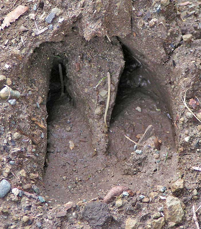
The first part of the trail through a hydro right-of-way may appear uninviting but there are already many signs of wildlife for an observant naturalist. New gravel and wood steps parallel a muddy path that reveals footprints larger than deer – probably elk. Common birds are prevalent – robins, towhees, song sparrows – but also among the trees, an elusive red-breasted sapsucker. The pink blooms of salmonberry attract buzzing rufous hummingbirds. Keen ears will also identify orange-crowned and yellow-rumped warblers at this time of year, in the brushy area of the estuary. Following the complex song of the ruby-crowned kinglet may result in a good view of these insect foragers in the lower trees.
The trail descends to the marshy estuary of Menzies Creek where beavers have been busy gnawing trees and dam-building. Crossing the creek is an entertaining experience – the metal suspension bridge rocks and sways, amplifying footsteps. On the other side, a patch of old-growth with huge Sitka spruce shelters forest flowers. The typical west coast forest begins just beyond.
Wildflowers and Songbirds
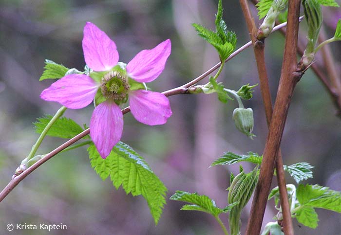
In April the spring flowers are at their peak throughout Vancouver Island, and this trail is no exception. Pink & white fawn lilies, yellow violets, trillium, bleeding heart, mimulus (monkeyflower), chocolate lily, and salmonberry bloom at intervals for the sharp-eyed photographer. In a couple of spots, the fawn lilies and bleeding heart grow on bluffs, allowing photos from below.
Along the forested trail, winter wrens sing every few hundred metres. The repetitive call of nuthatches, high trill of golden-crowned kinglets, chatter of flickers, and the even more rapid high chatter of a merlin can accompany the hiker. Shelf fungus on fallen logs may be mistaken for butterflies at first glance. The occasional pile of shredded cone bracts indicates the feeding spots of squirrels.
Signs of Historic Logging

Look carefully at the bridges – one actually crosses an old skid road used for conveying logs down to the water. High points along the trail provide views of the log booms in the bay as well as far-away mountains such as Mt. Albert Edward in Strathcona Park. Several beach accesses to Menzies Bay are worth exploring for low tide life, as is the sandy bay further along at Nymphe Cove. The trail then becomes more rugged and the last clamber up the bluffs requires caution to negotiate whether headed up or down. The final reward is a panoramic view north up Seymour Narrows, and east to Quadra Island, linked by causeway to Maud Island directly ahead.
Viewing Seymour Narrows
Bring binoculars, as there will be gulls, cormorants, and other seabirds – or even a red-tailed hawk soaring against the forests of the other side. Maritime traffic of all kinds must pass through this narrow passage, which still has dangers – currents can reach 15 knots, and whirlpools can drag a boat to the bottom. Slack water is best for navigation, but for the most drama the tidal patterns are best viewed at high current when ripples, whorls, and whirlpools form. The passage can however appear quite benign if the difference between high and low tide is less than 6 feet. You may even spot hikers on the bluffs on other side (the Maud Island trail – but that’s another article!)
Need to Know:
- The trailhead parking area has a reputation for vehicle break-ins, so don’t leave valuables inside. On nice days there are plenty of other hikers on the trail, so less chance of bad luck.
- The final short bluff ascent may require some mountain goat footwork! Exercise caution. Nymphe Cove is also a good final destination for the less inclined.
- On your way you may wish to stop at the Campbell River Museum for more historical background.
Use the Google Map below to find the Ripple Rock Trail.
Ripple Rock Hiking Trail, Strathcona, BC V0P 1H0, Canada
About the Contributor:
Krista Kaptein is an intermittent hiker, naturalist, writer, & photographer based in the Comox Valley, Vancouver Island, British Columbia.