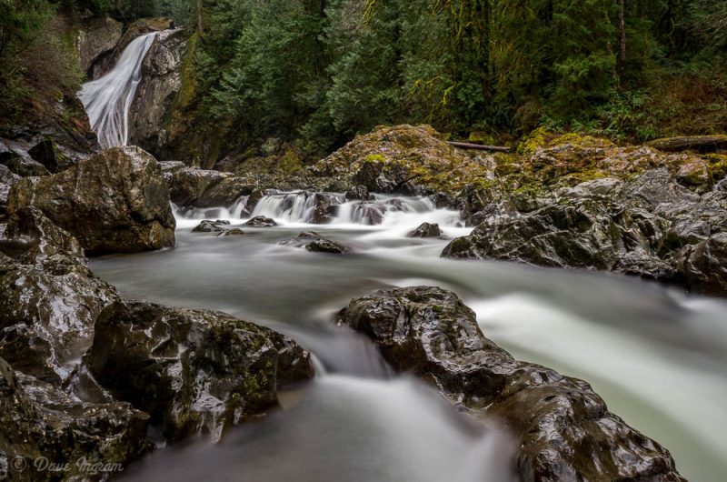
Even in the wet drizzle of a grey day, Olallie State Park is a special place. The South Fork of the Snoqualmie River tumbles over boulders as it makes its way down through the Cascades towards Everett and ultimately, Puget Sound. I stopped in on my way south to Seattle back in December, 2013 when the trail was still in good shape.

It looks possible to take a short cut almost directly down to the trail close to Twin Falls from I-90, but the longer approach is well worth it. Walking along the Snoqualmie one gets a sense of the timelessness of the lush rainforest on either side of the river. Massive red cedars and Douglas-fir grow in this damp river valley, as does big-leaf maple wrapped in thick moss and cascades of liquorice fern. Red-alder lines the open areas along the river where the forest is shaped and altered by seasonal water flows.

The first stretch of trail is fairly flat and level. Closer to Twin Falls, it gains elevation and works its way around a ridge before descending again. At this lower point it is possible to access the river and with a bit of scrambling get a view of Twin Falls from river level. I stopped here on the way back to photograph the river and Twin Falls upstream. It should be possible to work through the boulders at the base of the ridge and get a better unobstructed view of the falls, but it looked a little tricky and the weather was less than ideal and the day was getting late. I was content to enjoy the river with the fine company of an American dipper.
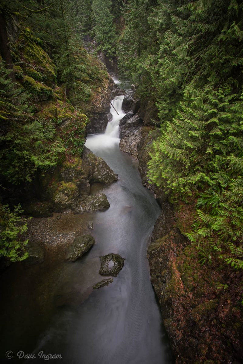
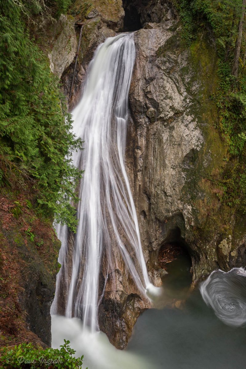
The trail rises again to climb a second ridge. On my way in I actually by-passed the stairs and walkway that leads to a spectacular viewing platform opposite the main 45 meter drop of Lower Twin Falls and pushed on to the Middle and Upper Twin falls. A bridge crosses over the river and provides an excellent view down the steep sided valley to the Middle Twin Falls.

On the other side of the bridge, the trail continues to climb to another viewing area with partial views of the Upper Twin Falls, a much smaller 4.5 meter punch bowl waterfall. There’s a rough trail that leads down to the base of this waterfall, but it wasn’t really worth it at this time of year—you get a better unobstructed view of the waterfall, but the high volume of water and mist in the air made photography impossible.

On the way back I stopped at the lower viewing platform and was stunned by the beauty of Lower Twin Falls. The river flows in delicate strands over smooth sloping rock face into a deep pool. You get a real feeling of the height of the falls and the unrelenting power of the water that has shaped the stone over countless years.
The hike out to Twin Falls is a very doable family 4 km (2.5 miles) round trip even with the two climbs in the middle. Make sure to take your time and enjoy the river and the forest along the way out and back. A Washington State Parks day or annual pass is required and can be purchased at the Twin Falls trailhead.
Need to Know:
- Access to Twin Falls via the Twin Falls Trailhead is currently closed due to a landslide that damaged the trail in January, 2014. Washington State Parks advises hikers to use the Homestead Valley Trailhead instead.