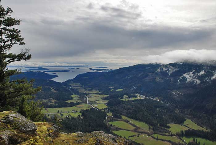
Over the March Break we took a family trip to Salt Spring Island and explored some of the provincial parks on the island. One of the highlights was Mount Maxwell Provincial Park, and the viewpoint from the bluffs at Mount Maxwell (also called Mount Baynes). Given the weather (cloudy and wet) we weren’t expecting much of a view but we were delightfully surprised.
From Ganges we followed Cranberry Road (which turns into the Mount Maxwell Road) until it turned to gravel. The next section was where the adventure truly began.

Signage on the road indicated that the road was not recommended for large RVs and the BC Parks web site describes the road as “steep, narrow and bumpy.” We were driving a Toyota Corolla and did need to be very creative about straddling the low points and avoiding bumpy sections. In two places on the way up we bottomed out briefly and ended up pulling over on a wider section of the road a short distance from the main viewpoint. The road did not appear to have been recently graded in March 2010.

As we walked along the road through a stand of old second-growth Douglas-fir the sky began to clear and the rain stopped. At 602m (1975 ft.) this is one of the higher points on Salt Spring Island and the sheer drop provides a wonderful viewpoint. From the lookout we had magnificent views of Sansum Narrows to the west and Burgoyne Bay directly below. Looking to the southeast, we could see farms in the valley and Fulford Harbour beyond.

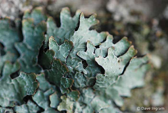
From a naturalist’s perspective Mount Maxwell Provincial Park was interesting as well. A large conglomerate rock formation at the top provided an opportunity to find a variety of different lichens. The nearby Mount Maxwell Ecological Reserve protects one of Canada’s largest Garry Oak meadows and a significant number of rare associated plants and animals. Note that a permit is required to enter this Ecological Reserve.


After a brief respite from the rain the clouds began to move in again. We returned to the car and made our way back down the gravel road to Ganges. With a little luck we didn’t bottom out on the way down. Mount Maxwell was definitely worth the effort and merits a return trip and a little more time to explore.
Need to Know:
- Be aware that the gravel portion of the Mount Maxwell Road is very rough in places. With some care and strategic driving you can avoid most of the deep potholes and ruts. RVs are definitely not recommended – the road is steep and narrow making it very difficult (if not impossible) to turn around a large vehicle.
- The bluffs are very steep and the chain link fence at the edge is there for a reason. Do not go beyond it.
- Those thinking of climbing Mount Maxwell from Burgoyne Bay might be interested in reading about a 1922 climb by Colonel Richard Greer and Captain Horace Westmorland recorded in Victoria’s Daily Colonist.